RTK-G + Datalink Pro Pack
$4,599.00
$4,599.00
per item

Ideal for environments that need to withstand magnetic interference from metal structures.
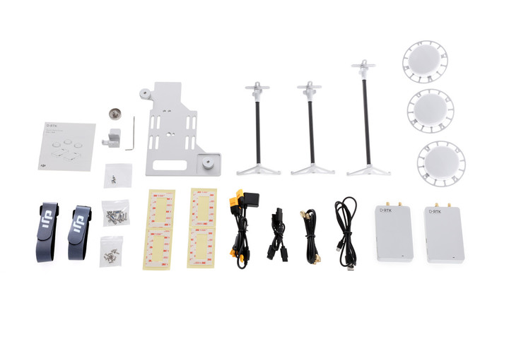
D-RTK GNSS is a high precision navigation and positioning system. Using dynamic differential technology, it provides ultra-accurate, centimeter level 3D positioning. This enhanced accuracy over typical barometer, compass and GPS systems makes D-RTK essential for commercial, industrial and scientific applications where accuracy is imperative. Using dual antennas, its heading reference is more accurate than a compass sensor, and it is able to withstand magnetic interference from metal structures.
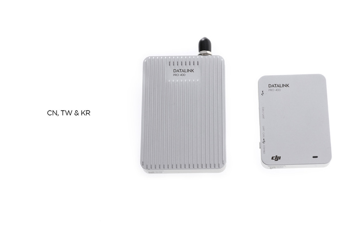
RTK-G: Using a GPS+GLONASS dual positioning module, RTK-G is suitable for most countries and regions worldwide.
Terms and Conditions
D-RTK GNSS is a high precision navigation and positioning system. Using dynamic differential technology, it provides ultra-accurate, centimeter level 3D positioning. This enhanced accuracy over typical barometer, compass and GPS systems makes D-RTK essential for commercial, industrial and scientific applications where accuracy is imperative. Using dual antennas, its heading reference is more accurate than a compass sensor, and it is able to withstand magnetic interference from metal structures.
RTK-G: Using a GPS+GLONASS dual positioning module, RTK-G is suitable for most countries and regions worldwide.
Terms and Conditions
SKU: