
BUILT IN THE USA. PROVEN EVERYWHERE.
LiDAR applications

Your world.
Measured in 3D.

Better site plans. Deeper research. New discoveries. Start with what you need to know.

Find your application
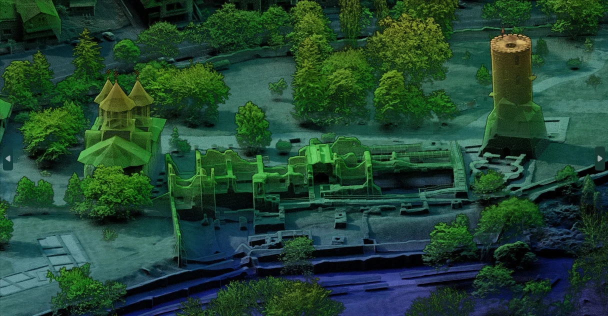
Detailed LiDAR view of Romania’s Royal Court, showing historic structures, trees, and the surrounding landscape
From the real world to a measurable one.

One technology.
A world of possibilities.

Actual LiDAR point cloud · Royal Court, Romania

Different work.
A clearer picture.

Four ways to turn spatial data into your next informed decision.

From possibility to a practical workflow

See what it means
for your work.

Explore the deliverables, the decisions, and the support behind each application.

Land development

From land
to building.

Bring terrain, slopes, and existing features into a shared 3D record. Give developers, surveyors, and engineers the information to evaluate a property before committing to a design.

Explore land development
LiDARUSA / Field notesLand development
From land to building 01

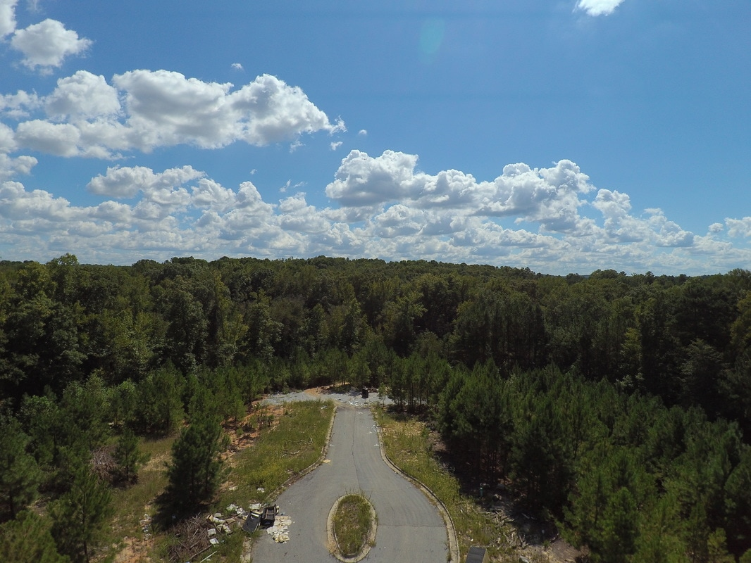
Start with the site.

Roads, vegetation, and access give you the first view. A measured survey adds the shape and elevation information a photograph alone cannot provide.
A measured starting point.
Aerial photograph of a road ending at a wooded development site
Site context · supplied aerial photograph
From land to building 02

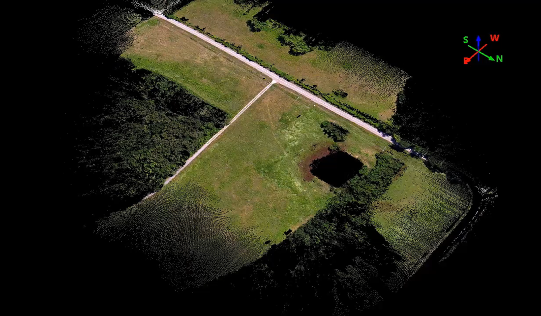
Bring the landscape into 3D.

Explore measured features together in a point cloud. Color adds visual context when suitable imagery has been collected and aligned.
A measured starting point.
Colorized point cloud showing a road, open ground, trees, and a depression
Spatial context · colorized point cloud
From land to building 03

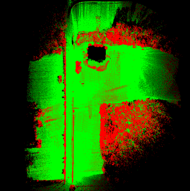
Separate the features.

Classification helps organize the point cloud for the task. Review the resulting classes and ground coverage before building terrain outputs.
A measured starting point.
Point cloud with features shown in red and green
Processing view · color-coded point cloud
From land to building 04

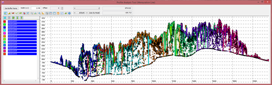
Look across the landscape.

A profile provides another way to inspect height changes and the relationship between the ground and features above it.
A measured starting point.
LiDAR profile analysis showing a cross-section through terrain and vegetation
A different perspective · profile analysis
From land to building 05

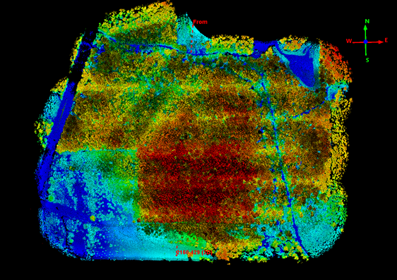
Read the shape of the land.

Elevation views help communicate changes in height. Use them to focus questions about slopes, low areas, and potential layout options.
A measured starting point.
Point cloud of a landscape colored by elevation
Terrain context · elevation-colored point cloud
From land to building 06

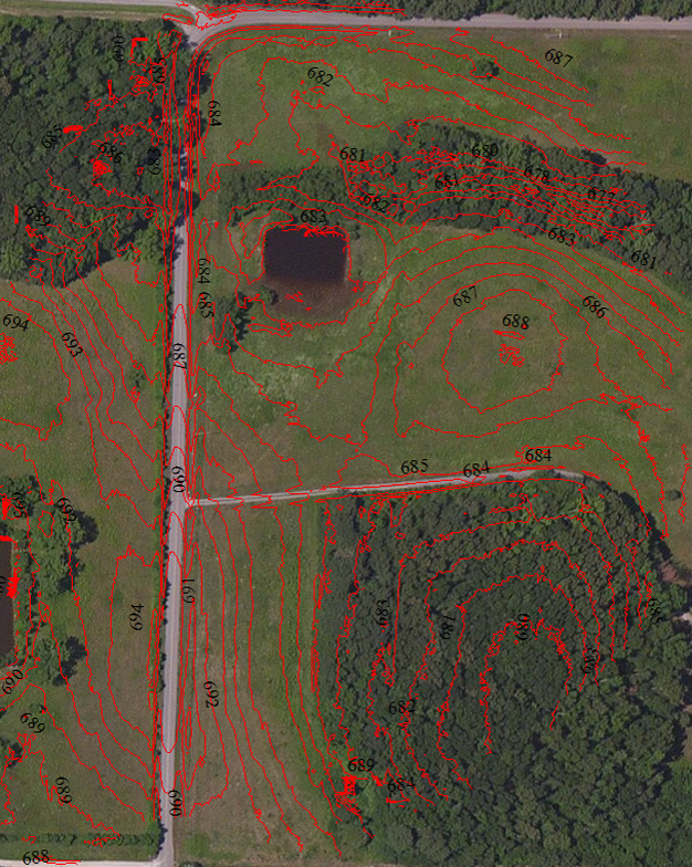
Give design a measured base.

Prepare terrain models and contours in agreed coordinates and formats. Engineers can use the existing-ground surface to explore grading and compare design options.
A measured starting point.
Existing LiDARUSA contour visualization over aerial imagery
Design handoff · existing terrain and contour visualization
From land to building 07

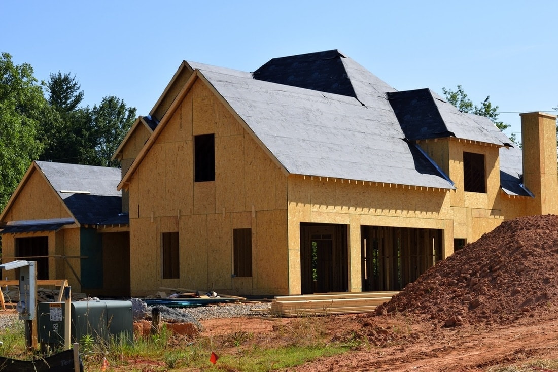
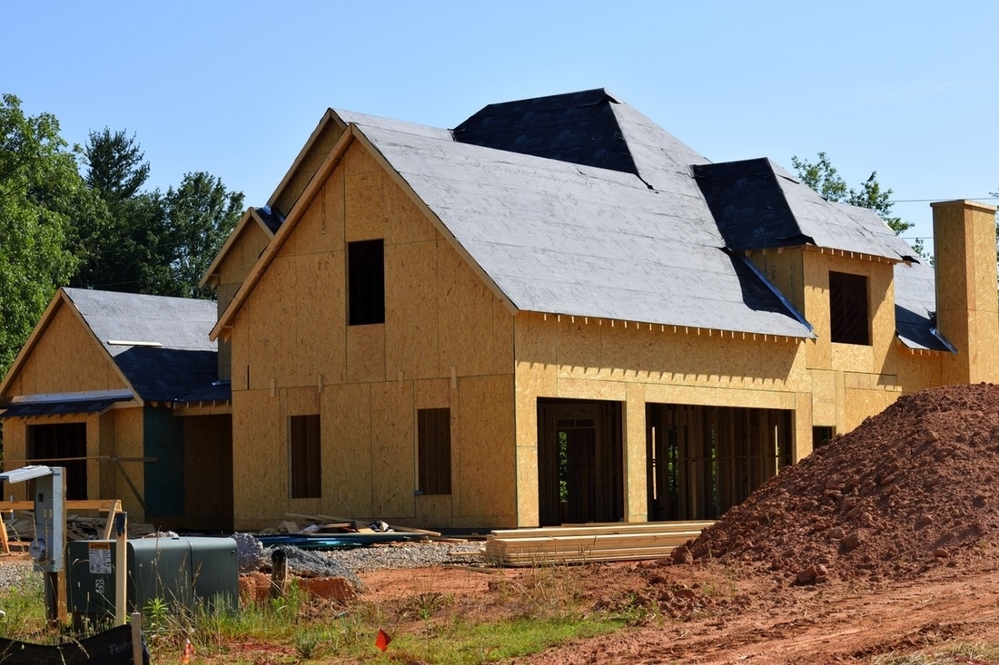
Move from plans to building.

Carry the measured ground into planning, grading, and construction decisions. The goal is a site the project team can understand before the building takes shape.
A measured starting point.
House under construction with wood sheathing, roof underlayment, and earthworks in the foreground
Construction stage · building in progress

Click the right page to turn forward. Click the left page to go back.

Page 01 / 07
Evaluate the site
Review slopes, low areas, access, and potential building-pad locations.
Plan the earthwork
Compare existing and proposed surfaces to support cut-and-fill decisions.
Hand off useful data
Prepare point clouds, bare-earth models, and contours for CAD and GIS.

Terrain data supports planning. It does not establish boundaries or identify buried utilities. Construction photo is illustrative, not a documented project. These examples show different views of a LiDAR workflow, not a before-and-after record of one site.
02 / 04 Universities & research

The next generation.
Ready for the field.

Connect the classroom to real collection, processing, and interpretation. Build a LiDAR program around what you teach, what you research, and the people who will use the system.

Explore education & research
01

Follow the question into the field.

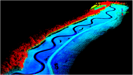
A river corridor becomes a hands-on dataset. Connect collection planning with the landscape students and researchers need to understand.

LiDAR point cloud of a winding river corridor with vegetation colored by height
University & research example · river-corridor point cloud
02

Turn measurements into understanding.

Work through positioning, alignment, classification, and quality checks. Then use the dataset to investigate a research question or explain a design decision.

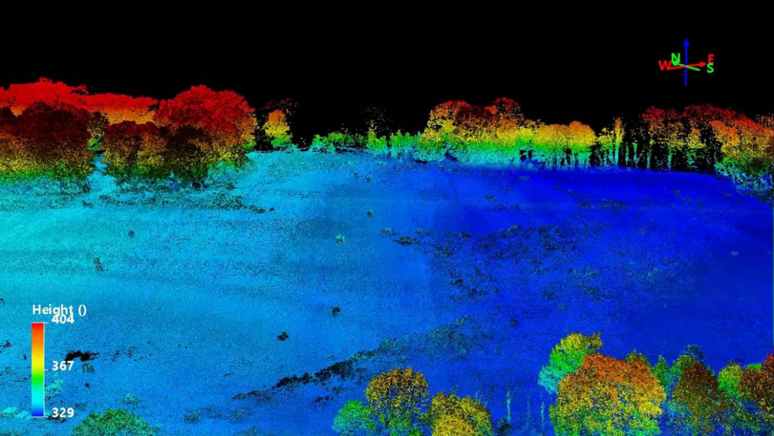
Existing LiDARUSA point cloud of terrain and trees colored by height
From fieldwork to interpretation · example LiDARUSA data
University discounts
Education pricing is available to all universities.
Free training
Help your team build confidence from field setup to the finished point cloud.
Free support
Get help as questions arise in teaching, fieldwork, and research.

Explore applications across surveying, civil engineering, GIS, forestry, and archaeology.

03 / 04 Agriculture & environmental research

Understand the land.
Measure what’s growing.

Build a measurable picture of fields, orchards, and changing landscapes. Combine LiDAR geometry with imagery when your research needs both structure and visual context.

Explore agriculture
01

Structure meets visual context.

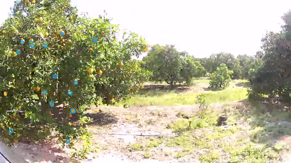
Use LiDAR for terrain and vegetation geometry, then add camera imagery when the project needs visual interpretation. Repeatable collection and field validation make the results more useful.

Orchard trees with visible fruit marked by blue detection circles
Orchard imagery · fruit-detection demonstration
Terrain & water
Use elevation, slope, and potential flow paths to inform drainage planning.
Crops & canopies
Study vegetation height, canopy shape, and orchard structure in 3D.
Change over time
Compare aligned surveys to investigate growth and landscape changes.

Fruit detection is an imagery-analysis task, not an automatic LiDAR output. Ground coverage depends on vegetation and collection conditions.

04 / 04 Archaeology & cultural heritage

Hidden landscapes.
New starting points.

From ancient settlements beneath vegetation to historic places above ground, LiDAR gives investigators a landscape to explore—and a digital record to return to.

Explore archaeology & heritage
01

Give investigation a starting point.

Create a detailed spatial record to explore and revisit. Terrain patterns can guide closer investigation; archaeological expertise gives those features their context.

LiDAR point cloud of historic structures and trees at Romania’s Royal Court
Cultural heritage in 3D · Royal Court, Târgoviște, Romania
Reveal the terrain
Investigate landforms using bare-earth models and contour maps.
Document the place
Create point clouds and spatial records of historic landscapes.
Learn from the field
Explore expedition stories from Italy, Guatemala, Florida, and Alaska.

A mapped feature is a starting point—not proof of a tomb or treasure. Interpretation requires archaeological expertise and field investigation.

Built around your deliverable

Your application.
Your LiDAR system.

Tell us what you need to capture and deliver. We’ll help match the sensor, platform, positioning, and workflow to your project.

Have a different mapping challenge? Let’s talk about it.