• Home
  • Newsletter
  • PRODUCTS
    • Surveyor 32
    • Surveyor 32 MAX
    • Revolution 120
    • Surveyor mini series >
      • SURVEYOR MINIV2 Riegl
      • SURVEYOR MINIV3 Riegl
    • Surveyor High Accuracy Series >
      • Surveyor VUX Riegl
      • Surveyor DUAL VUX - Riegl
      • Surveyor CL360
    • Highway Mapper Series >
      • HiWay Mapper Z & Snoopy Custom
    • UAV / Drones
  • Resources
    • myPointClouds.com
    • SAMPLE DATA
    • Pictures
    • Videos
    • Applications >
      • Surveying/Mapping
      • Education
      • Law Enforcement
      • Military
      • Archeology
      • Agriculture
    • Financing
  • SUPPORT
    • SUPPORT TICKETS
    • WIKI Support
    • RESOURCES >
      • Remote Support
      • Case Studies
      • FAQ
      • Warranty, Terms & Conditions
      • Learn
  • News
  • About
    • About Us
    • Contact
    • Jobs
LIDAR USA - UAV DRONE 3D LIDAR MOBILE MODELING MAPPING GIS EXPERTS
  • Home
  • Newsletter
  • PRODUCTS
    • Surveyor 32
    • Surveyor 32 MAX
    • Revolution 120
    • Surveyor mini series >
      • SURVEYOR MINIV2 Riegl
      • SURVEYOR MINIV3 Riegl
    • Surveyor High Accuracy Series >
      • Surveyor VUX Riegl
      • Surveyor DUAL VUX - Riegl
      • Surveyor CL360
    • Highway Mapper Series >
      • HiWay Mapper Z & Snoopy Custom
    • UAV / Drones
  • Resources
    • myPointClouds.com
    • SAMPLE DATA
    • Pictures
    • Videos
    • Applications >
      • Surveying/Mapping
      • Education
      • Law Enforcement
      • Military
      • Archeology
      • Agriculture
    • Financing
  • SUPPORT
    • SUPPORT TICKETS
    • WIKI Support
    • RESOURCES >
      • Remote Support
      • Case Studies
      • FAQ
      • Warranty, Terms & Conditions
      • Learn
  • News
  • About
    • About Us
    • Contact
    • Jobs

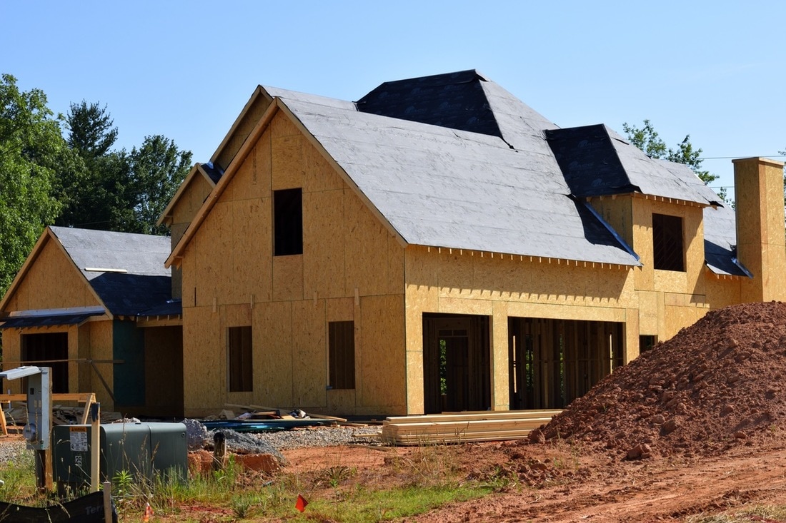
The days of speculating what a parcel of land looks like prior to purchasing it are over. Without setting foot on the property, and before even entertaining the idea of making a bid, you can get an extremely accurate view of the land to see if it is the parcel right for you. 
Picture
UAV LIDAR will definitely be a major benefit to the real estate developer.
Picture
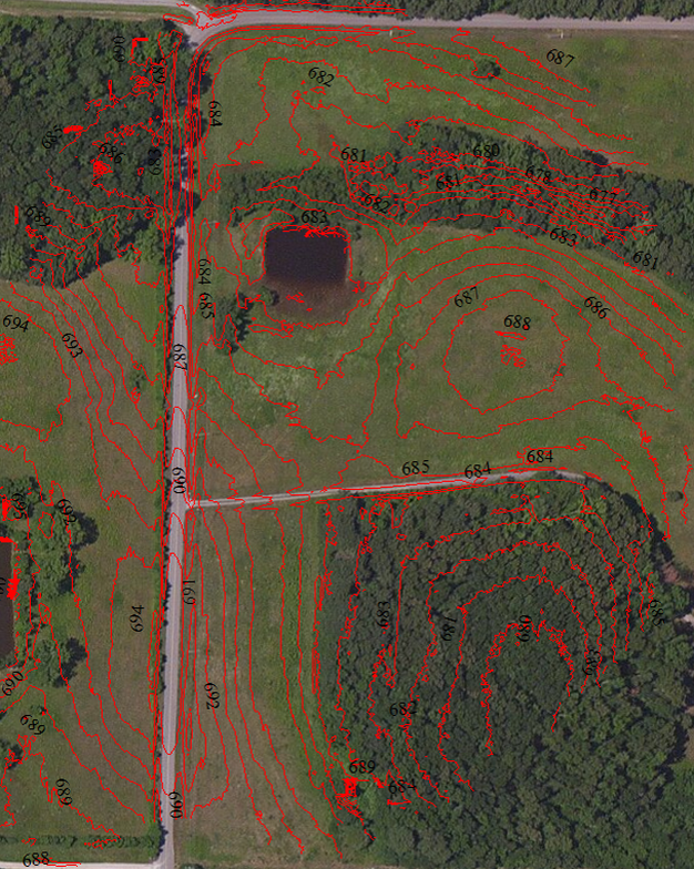
Using a ScanLook LIDAR system on a UAV, you can easily fly a small 10 acre lot, or maybe several hundred acres, and capture more detail than you would if you were to walk the parcel. 
In under 20 minutes, in a single flight, you can cover upwards of just over 100 acres. If you have a bigger lot, bring more batteries and maybe even a generator to re-charge in the field, fly the entire area. ​
​Search out low, wet spots that might be a problem for wetlands or seek out mounds and pits that might be considered ancient burial grounds. Even do a design for a roadway if necessary. Clear some trees. Analyze your views. 
Picture
Back in the office generate the point cloud, bare earth classify, and possibly colorize your point cloud. Drop the result into a suitable view such as our web-based browser and freely move around. 

Picture

A-Series

V-Series

HiWay Mapper

 1999–2022 Fagerman Technologies, dba. LiDARUSA.  All rights reserved.


Picture
​Sales/Main: 256-274-1616
sales@lidarusa.com
Picture
  • Home
  • Newsletter
  • PRODUCTS
    • Surveyor 32
    • Surveyor 32 MAX
    • Revolution 120
    • Surveyor mini series >
      • SURVEYOR MINIV2 Riegl
      • SURVEYOR MINIV3 Riegl
    • Surveyor High Accuracy Series >
      • Surveyor VUX Riegl
      • Surveyor DUAL VUX - Riegl
      • Surveyor CL360
    • Highway Mapper Series >
      • HiWay Mapper Z & Snoopy Custom
    • UAV / Drones
  • Resources
    • myPointClouds.com
    • SAMPLE DATA
    • Pictures
    • Videos
    • Applications >
      • Surveying/Mapping
      • Education
      • Law Enforcement
      • Military
      • Archeology
      • Agriculture
    • Financing
  • SUPPORT
    • SUPPORT TICKETS
    • WIKI Support
    • RESOURCES >
      • Remote Support
      • Case Studies
      • FAQ
      • Warranty, Terms & Conditions
      • Learn
  • News
  • About
    • About Us
    • Contact
    • Jobs