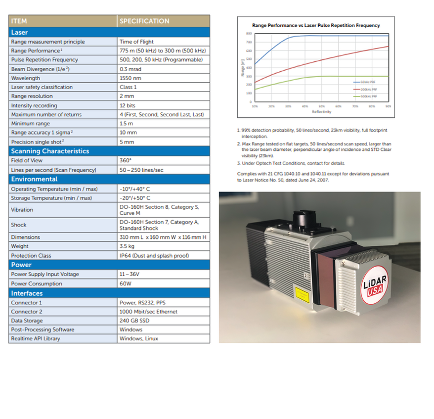
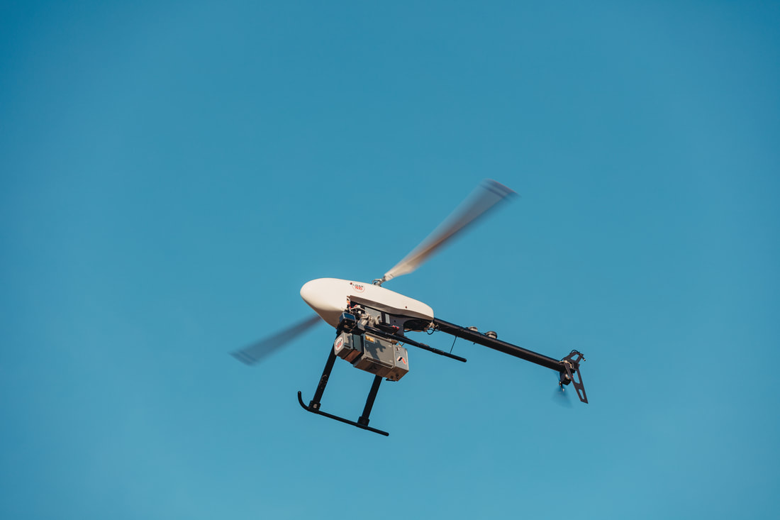
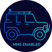
• Home
  • Newsletter
  • PRODUCTS
    • Surveyor 32
    • Surveyor 32 MAX
    • Revolution 120
    • Surveyor mini series >
      • SURVEYOR MINIV2 Riegl
      • SURVEYOR MINIV3 Riegl
    • Surveyor High Accuracy Series >
      • Surveyor VUX Riegl
      • Surveyor DUAL VUX - Riegl
      • Surveyor CL360
    • Highway Mapper Series >
      • HiWay Mapper Z & Snoopy Custom
    • UAV / Drones
  • Resources
    • myPointClouds.com
    • SAMPLE DATA
    • Pictures
    • Videos
    • Applications >
      • Surveying/Mapping
      • Education
      • Law Enforcement
      • Military
      • Archeology
      • Agriculture
    • Financing
  • SUPPORT
    • SUPPORT TICKETS
    • WIKI Support
    • RESOURCES >
      • Remote Support
      • Case Studies
      • FAQ
      • Warranty, Terms & Conditions
      • Learn
  • News
  • About
    • About Us
    • Contact
    • Jobs
LIDAR USA - UAV DRONE 3D LIDAR MOBILE MODELING MAPPING GIS EXPERTS
  • Home
  • Newsletter
  • PRODUCTS
    • Surveyor 32
    • Surveyor 32 MAX
    • Revolution 120
    • Surveyor mini series >
      • SURVEYOR MINIV2 Riegl
      • SURVEYOR MINIV3 Riegl
    • Surveyor High Accuracy Series >
      • Surveyor VUX Riegl
      • Surveyor DUAL VUX - Riegl
      • Surveyor CL360
    • Highway Mapper Series >
      • HiWay Mapper Z & Snoopy Custom
    • UAV / Drones
  • Resources
    • myPointClouds.com
    • SAMPLE DATA
    • Pictures
    • Videos
    • Applications >
      • Surveying/Mapping
      • Education
      • Law Enforcement
      • Military
      • Archeology
      • Agriculture
    • Financing
  • SUPPORT
    • SUPPORT TICKETS
    • WIKI Support
    • RESOURCES >
      • Remote Support
      • Case Studies
      • FAQ
      • Warranty, Terms & Conditions
      • Learn
  • News
  • About
    • About Us
    • Contact
    • Jobs
Picture
inertial-navigation-and-mapping-webinar_final.pdf
File Size: 3752 kb
File Type: pdf
Download File

Picture
Picture

UAV

Picture

CAR

Picture
"The Snoopy CL-360 allows my survey team to capture even the smallest static wire when performing utility corridor surveys"
VP, utility inspection company
Press release Surveyor CL360

SAMPLE DATA

please email sales@lidarusa.com
Picture

Road

Picture

Utility

Picture

Topography 

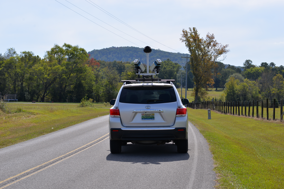
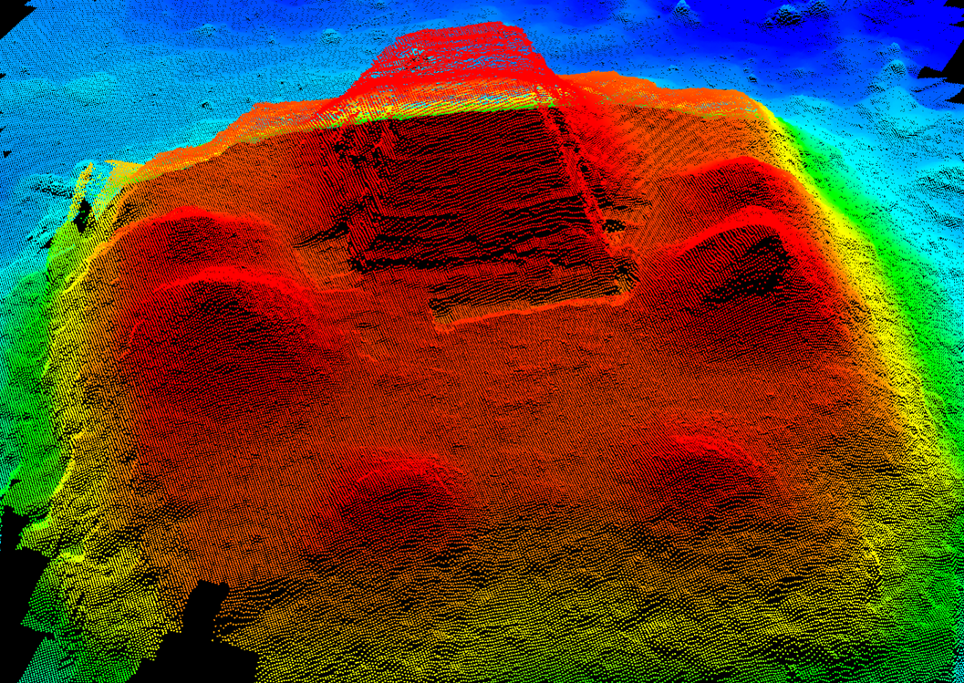
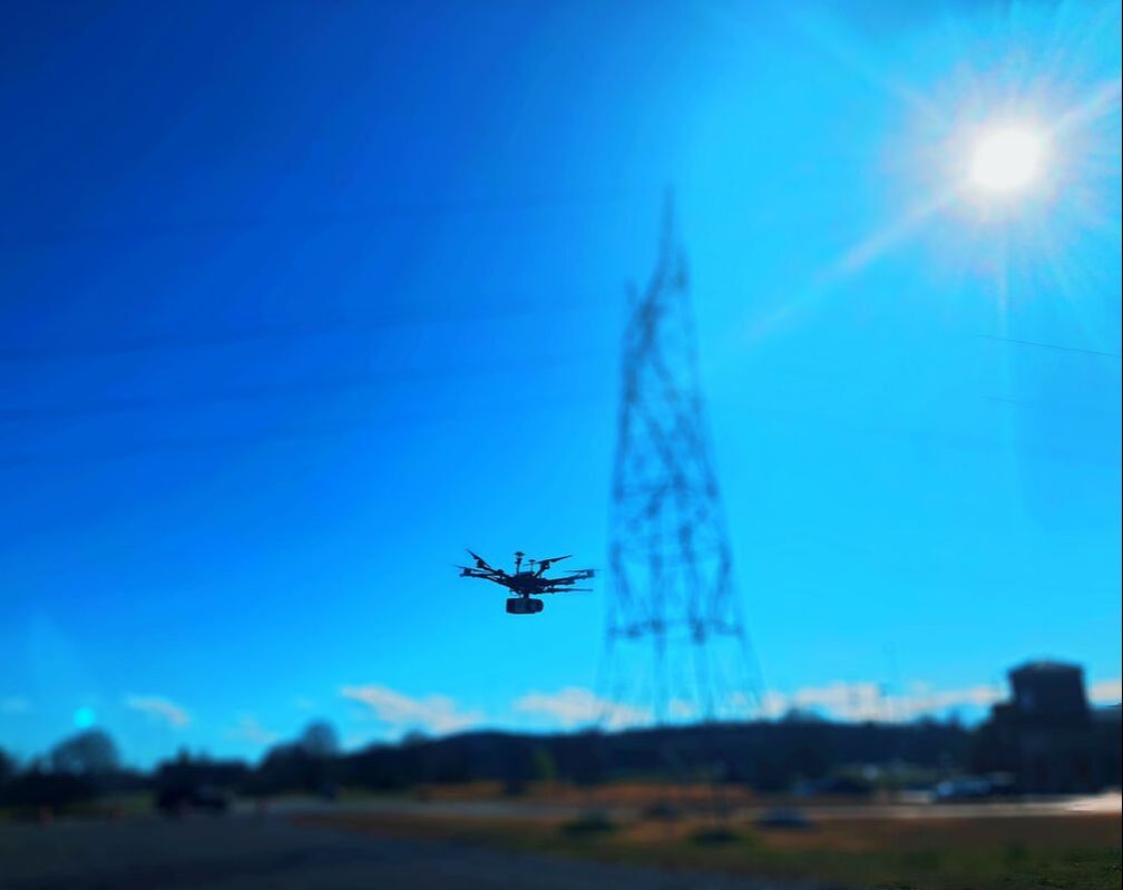
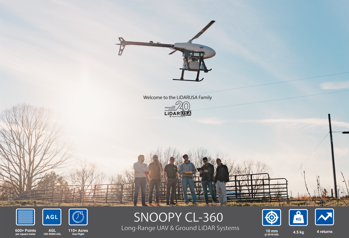
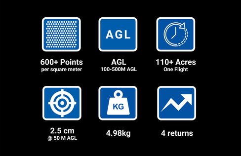
The Surveyor CL360 is a high accuracy LiDAR System capable of being mounted to a UAV, Car, or Backpack.  Paired with our high accuracy IMU this system delivers Survey Grade Accuracy.  After performing several months of testing in very difficult locations we have verified this system is one of the most accuracy LiDAR systems you can purchase for the money. 
​https://aerospace.honeywell.com/us/en/learn/about-us/customer-success-stories/lidar-greater-location-accuracy-honeywell-imu
CASE STUDY
High Accuracy LiDAR

 1999–2022 Fagerman Technologies, dba. LiDARUSA.  All rights reserved.


Picture
​Sales/Main: 256-274-1616
sales@lidarusa.com
Picture
  • Home
  • Newsletter
  • PRODUCTS
    • Surveyor 32
    • Surveyor 32 MAX
    • Revolution 120
    • Surveyor mini series >
      • SURVEYOR MINIV2 Riegl
      • SURVEYOR MINIV3 Riegl
    • Surveyor High Accuracy Series >
      • Surveyor VUX Riegl
      • Surveyor DUAL VUX - Riegl
      • Surveyor CL360
    • Highway Mapper Series >
      • HiWay Mapper Z & Snoopy Custom
    • UAV / Drones
  • Resources
    • myPointClouds.com
    • SAMPLE DATA
    • Pictures
    • Videos
    • Applications >
      • Surveying/Mapping
      • Education
      • Law Enforcement
      • Military
      • Archeology
      • Agriculture
    • Financing
  • SUPPORT
    • SUPPORT TICKETS
    • WIKI Support
    • RESOURCES >
      • Remote Support
      • Case Studies
      • FAQ
      • Warranty, Terms & Conditions
      • Learn
  • News
  • About
    • About Us
    • Contact
    • Jobs